Here’s a FREE (Open Data) digital map to download to laptop or phone, or to print. A digital map is useful to keep on your phone for when you are offline. A printed map is handy for when you are offline or out of data.
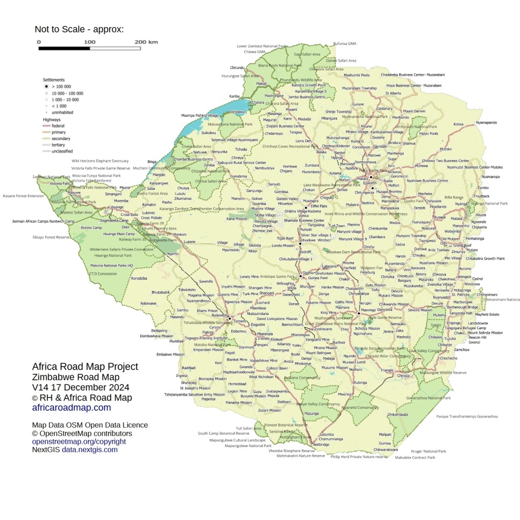
This is the latest version of our Zimbabwe map. It’s a draft work in progress, and errors exist. But it’s already a fascinating insight into being on the road in Zimbabwe. You can save this draft version to your phone for free as a medium quality JPEG. Or copy/save the map above for free.
To buy a high resolution PDF version of this map for digital viewing or printing onto an A3 sheet of printer paper, please see link below.
Better Quality Map for Printing
Click below to pay US$2 and we will email you a hi-resolution PDF of this digital map of Zimbabwe for printing on an A3 sheet of paper.
If the payment link is not working please email us and we can send a PDF by email.
T’s and C’s – a work in progress
The map on this page is the latest edition of our map. We’re constantly updating it. So please come back frequently for improvements and updates, especially to local services.
It’s based on OpenStreetMap data used under Open Data license. If you print or copy it, please include the credit above, as we have done. Read more here.
Use at your own risk: we have done our best to make sure the map is accurate, but please check all data before acting on it. Our liability is limited to the purchase price paid.
